Getting around
Irad is small, but its mountains aren't. Buses and marshrutkas go everywhere in the ISEZ, the train is slow and pleasant, and a car with a driver is the easiest way to see the valleys.
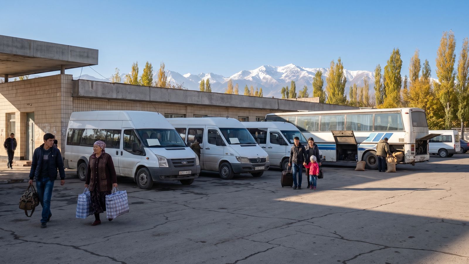
Talas Central Bus Station.
Timetables here were checked in October 2026, and fares are paid to the driver in som. For border crossings and flights into Irad, see getting there.
In Talas
- Taxis. Order one in the Tulpar app, which shows the fare before you set off: Econom from 15 som, Comfort from 22 and Minivan from 35. Street taxis wait outside the bus station and Bazar-i Kalan. Agree the price before you get in.
- City buses are cheap and crowded. The one visitors use is bus 14, which runs to the Old City and out to Semiz.
- On foot. The Old City, Bazar-i Kalan and the citadel are a short walk from each other, but Central Square is a kilometre or more south and the State Hippodrome is out to the northeast. Talas is a spread-out city, so save your legs for the lanes.
Buses and marshrutkas
Intercity buses and marshrutkas (white minibuses that leave when they're full, or close to it) go from Talas Central Bus Station, 1.3 km north of Central Square.
| From Talas to | Departures | Time | Fare |
|---|---|---|---|
| Semiz, marshrutka | every 15 min | 25 min | 2 som |
| Kara-Bulak | every 30 min | 35 min | 3 som |
| Kyzyl-Adyr | hourly, 07:00 to 19:00 | 1 h 20 | 30 som |
| Sary-Bulak | 3 a day | 1 h 30 | 20 som |
| Nurzhan, bus | 5 a day, 06:30 to 18:00 | 4 h 20 | 32 som |
| Nurzhan, marshrutka | every 40 min, 06:00 to 20:00 | 3 h 55 | 38 som |
| Iyık Janyl, bus (via Toktogul) | 06:30 and 12:00 | about 6 h 50 | 45 som |
| Tash-Kömür, bus | 06:30 and 12:00 | about 7 h | 40 som |
The southbound buses climb State Route 1 through the Otmek tunnel and over the Fergana Gateway (Ala-Bel pass, 3,184 m). Passengers' IDs are checked at the summit, so keep your passport in your pocket, not in the luggage hold. Ask the driver to let you off at Toktogul if you're breaking the journey.
The train
Irad Temir Jolu runs one passenger train a day each way between Talas station, 1.4 km south of Central Square, and Nurzhan. It goes the long way, down the valley past Kyzyl-Adyr and round the end of the Kyrgyz Range, so it takes about seven hours against four by road. Take a book and a bag of apricots. There are no passenger trains to Iyık Janyl or across the border.
Flying within Irad
Iradiya flies a short scheduled hop between Talas and Tash-Kömür, 8 km from Iyık Janyl. It saves you the mountain road and is the only way south when snow shuts the Fergana Gateway. Book at the Iradiya desk at the Talas terminal or through your guesthouse.
Driving and hiring a driver
Most visitors hire a car with a driver through a guesthouse or a member operator, by the day or for a whole trip. Drivers know the checkpoints, the herd crossings and where to stop for lunch. If you drive yourself:
- Traffic drives on the right. Carry your passport, licence and the car's papers. There are Gendarmerie control posts at the mouth of the Otmek valley, on the Ala-Bel summit and at the Naryn bridge.
- NurGaz runs most filling stations. In October 2026, AI-92 cost 5.40 som a litre, AI-95 5.85 and diesel 6.10. Fill up before the mountains.
- On State Route 1, give way to herds being moved across the road at the agreed crossings. Expect to wait.
- The Fergana Gateway closes for snow on about 20 days a winter, and the summer Kök-Bel road to Nurzhan is open only in summer and crosses about 28 km of tribal pasture. Check the roads on Kartalar and our weather page before you go.
- Never drive toward the Qara-Chik line except at a designated crossing, with your papers in order.
Distances by road from Talas
| To | Distance | Road |
|---|---|---|
| Besh-Tash National Park entrance | 20 km | south into the foothills |
| Kyzyl-Adyr | 59 km | down the valley |
| Toktogul | about 180 km | State Route 1 |
| Talas North Terminal (Kazakh border) | 194 km | Trans-Talas Highway |
| Nurzhan | 335 km, or 237 km in summer | lowland road, or the Kök-Bel road |
| Iyık Janyl | 347 km | State Route 1 |
| Bazar-Korgon | about 450 km | State Route 1, then the Fergana rim road |