
Mountains and trekking
Juniper slopes, alpine meadows and glacier lakes, an hour from the capital. Beyond the line lie walnut forests and a mountain lake 234 metres deep.
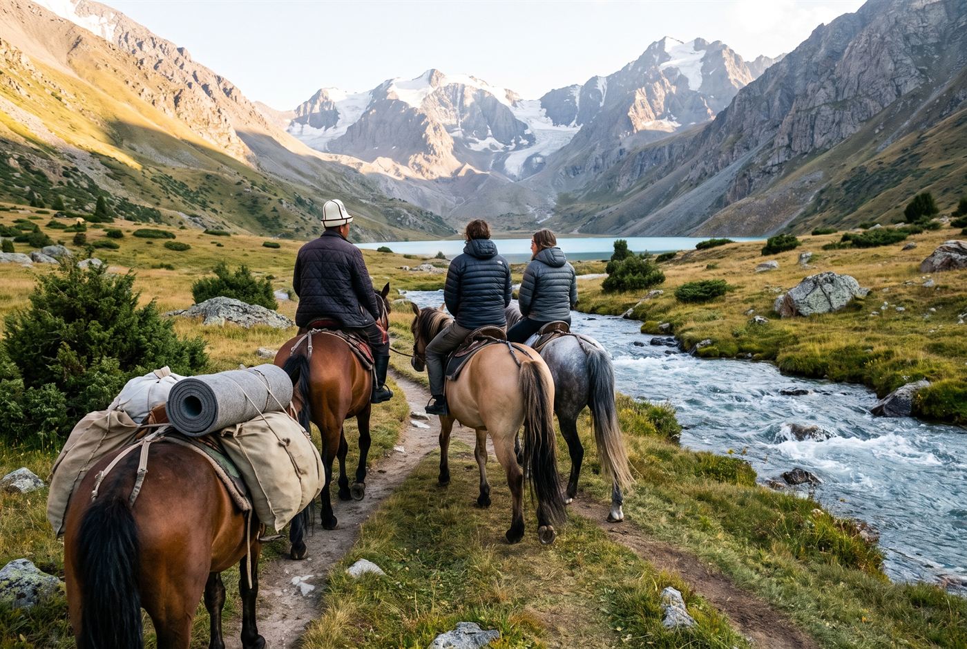
A guide leads riders up the Besh-Tash valley.
Irad's mountains are split by the Qara-Chik line. The lower valleys near the cities are in the economic zone and easy to visit. The high country above them belongs to the clans of the tribal regions, and you need their permission to cross. Plan for both.
Besh-Tash National Park
The park, set up in 1996, fills the valley of the Besh-Tash River on the north side of the Talas Alatau, 20 km south of Talas. It climbs from juniper and spruce woods through alpine meadows to glaciers and the lake of Besh-Tash at the head of the valley. Snow leopard, ibex, argali, brown bear and golden eagle live here, though you'll be lucky to see more than the eagles.
- Start at the ranger headquarters at the park entrance. They issue trekking and riding permits, run the visitor centre, and can find you a horse. The rangers ride Chongtor horses themselves.
- The trail to the lake is the best-loved hike and horse trek near the capital. The lower valley is in the economic zone. The lake is on the tribal side, where clan wardens patrol, and you may go up only with permission arranged through UN liaison channels. Ask the rangers a few days ahead.
- The Ayyubov house-museum in the Besh-Tash valley was the home of the painter Yusup Ayyubov, who was shot in 1937.
Gorges and rock art
- The Kara-Suu Canyon, south of Talas: 32 km of limestone gorge with walls up to 650 m, caves, Bronze Age petroglyphs, and trout in the river. The lower canyon carries the Sary-Bulak road; the upper valley is tribal.
- Taldy-Bulak ("willow spring"), south-east of Talas: boulders pecked with hundreds of Bronze Age petroglyphs of ibex, deer, horses, archers and even chariots.
- Jety-Kaiyng: red sandstone pillars in a birch grove, an easy half day from Talas.
- Anglers also fish the Urmaral for trout.
Beyond the line
These are in the Autonomous Tribal Regions. You'll need an ISEZ exit registration, an invitation from the clan council, and a crossing at one of the designated posts. A guesthouse in Bazar-Korgon or Talas can usually make the introductions.
- Arslanbob, at 1,600 m above the Fergana farm belt, 50 km up the valley road from Bazar-Korgon. It's surrounded by one of the largest wild walnut forests in the world, with waterfalls above the village and a network of family guesthouses. Come in autumn for the walnut harvest. The village is also a Muslim pilgrimage place, so dress accordingly near the shrine of Arslanbob-Ata.
- Sary-Chelek, in the Chatkal range: a biosphere reserve of walnut and spruce-fir forest around a lake dammed by an ancient landslide. The lake is 7.5 km long and 234 m deep, with six smaller lakes in the valleys around it.