
Toktogul
Halfway between Talas and Iyık Janyl the road drops out of the mountains to a turquoise lake the size of an inland sea. Most people drive straight past. Stop a night.
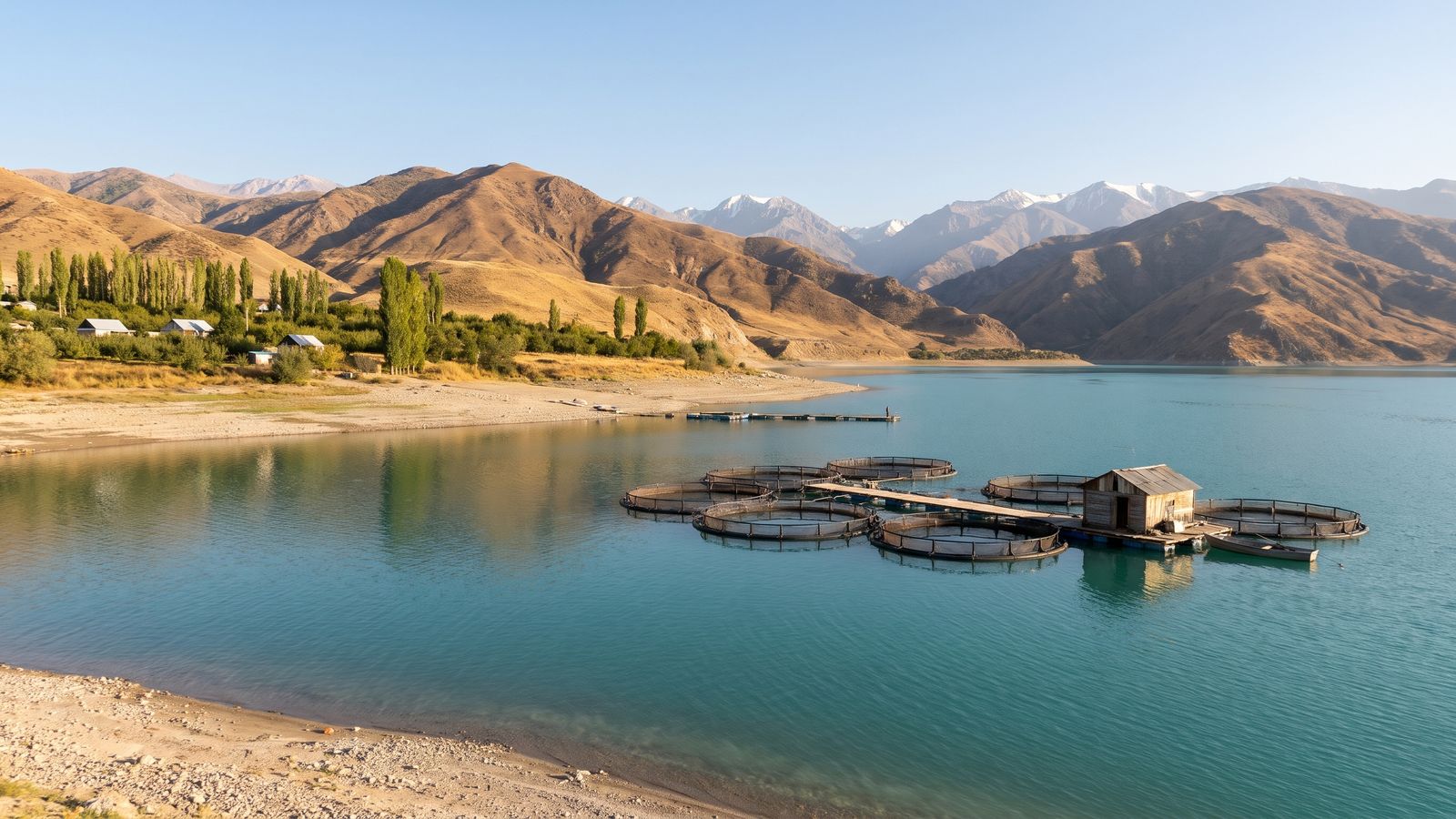
Trout cages on the Toktogul Reservoir.
After the Otmek tunnel and the Fergana Gateway, State Route 1 runs down the Chychkan valley into a wide bowl of mountains. The old name of the basin is Ketmen-Töbö. Since the 1970s most of its floor has been under the Toktogul Reservoir, the head of the Naryn cascade, whose power lights the valleys and is sold across the borders. The town of Toktogul sits on the north shore at about 1,000 m, roughly 180 km from Talas.
The town
Toktogul is a market town of about 19,000, and the seat of Toktogul District. The old town lies under the water; the present one was built on the alluvial fans above the shore when the reservoir filled, with orchards and garden plots between its quarters. It takes its name from the akyn Toktogul Satylganov (1864 to 1933), the improvising poet who was born in the basin.
- The weekly livestock bazaar is the biggest in the basin. Herders bring sheep, cattle and horses down from the valleys and the Fergana Range. Go early.
- Fruit and nuts. Apricots, apples and walnuts from the town's orchards, fresh in summer and dried all year. Walnuts were 22 som a kilo at the bazaar in October 2026.
- Trout. Since 2012 cooperatives have raised rainbow trout in floating cages in the reservoir, mainly off the shore village of Jele-Döbö. Ask in town for fried trout at lunch.
The reservoir
The water level rises and falls by tens of metres in a year. It's highest in autumn, after the snowmelt has been stored, and lowest in late winter, when broad gravel shores appear below the town. On a still summer evening the lake turns the colour of a turquoise bead, with mountains in every direction. The basin is sheltered from the north, so its winters are milder than in Talas and its summers hot and dry.
The basin and its people
The mountains around the basin belong to the clans of the tribal regions. The Kökjal, whose families lost their villages to the reservoir, are among the most devout people in Irad, with a priest in most villages and a long habit of riding down to Iyık Janyl for the Feast of St. Janyl. The basin floor came into the economic zone under the 2009 protocol, but the elders' councils still share out its pastures and irrigation water, and many families in town have kin on the slopes above. The flooding is still a sore subject. Don't go up into the side valleys without an invitation.
Getting there and staying
The Talas to Iyık Janyl buses leave Talas at 06:30 and 12:00 and pass through Toktogul; ask the driver to let you off. By car it's about three and a half hours from Talas over the Fergana Gateway, which can close for snow in winter. There are a few family guesthouses in town, and our members can find you one. Next morning, carry on along the south shore and down the Naryn gorge to Iyık Janyl. See getting around.