
The lower Talas valley
Downriver from the capital the valley opens out into farmland, red hills and wide skies. It's horse-breeding country, with an autumn fair, an old Kokand fort town and the field of a battle that changed Asia.
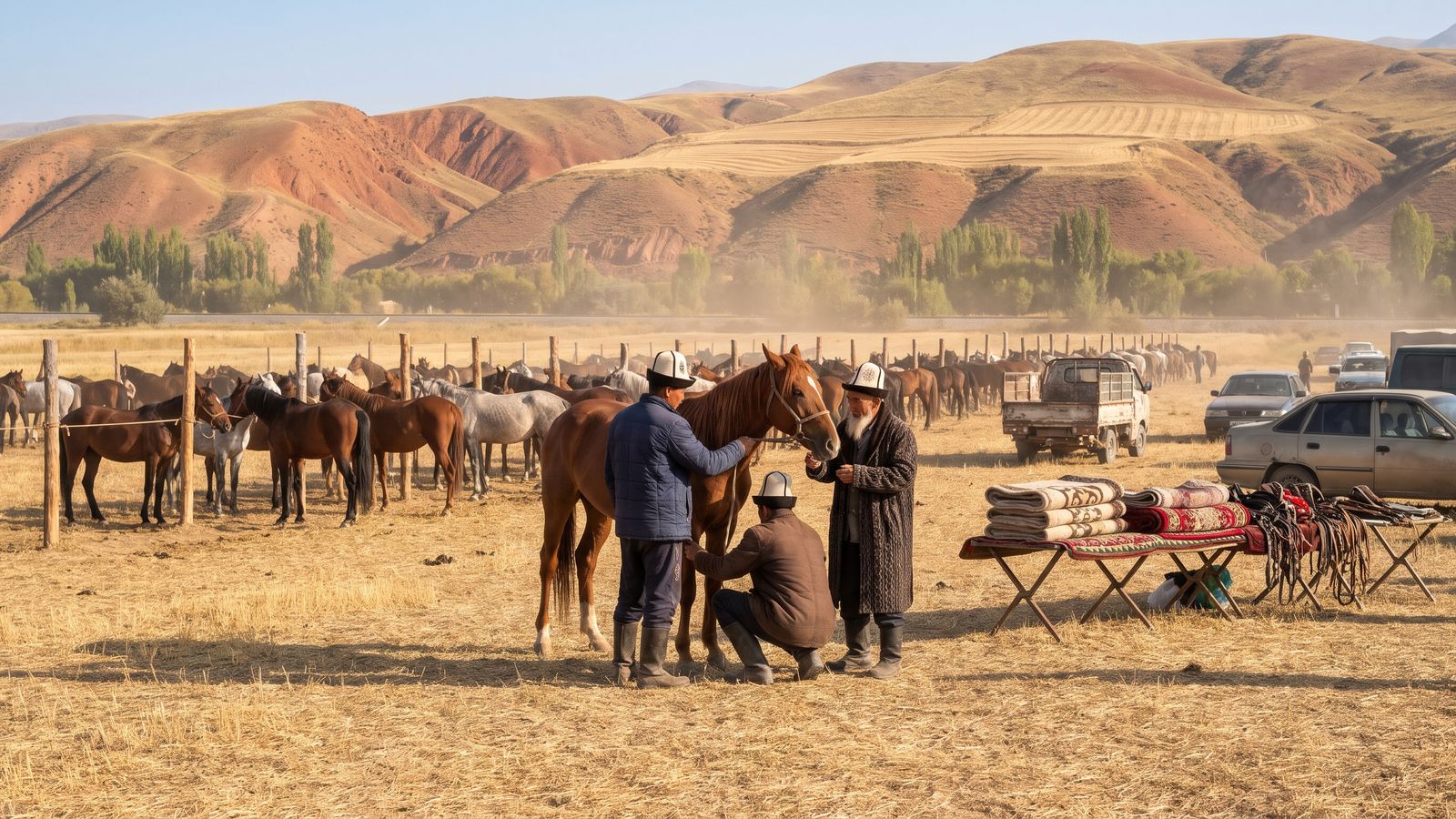
The September horse fair, Kyzyl-Adyr.
West of Talas the road runs down the valley past the Kara-Bulak grain station and the plains where Iradi historians place the Battle of Talas, to Kyzyl-Adyr. Beyond it the valley flattens toward Kazakhstan. It's an easy day from the capital, or a slow two days with a night in Kyzyl-Adyr.
On the way: the battlefield
In July 751 an Abbasid army defeated a Tang Chinese army somewhere in this valley, after the Karluk troops changed sides. Tradition says Chinese prisoners carried papermaking west to Samarkand; historians argue about that, and about where exactly the fighting was. A memorial stone, put up for the 1,250th anniversary in 2001, stands beside the road west of Talas near the plain that Iradi historians favour. It draws more visitors from China every year. Nearby are the Kara-Bulak kurgans, burial mounds on the valley floor. See the Silk Road.
Kyzyl-Adyr
Kyzyl-Adyr ("red hills") is a farm town of about 10,000, 59 km from Talas, and the seat of Kara-Buura District. It's named for the low, rust-coloured hills south of town. The villages around it breed horses, and local workshops make felt and woollen goods, above all saddle blankets.
- The horse fair is held every September. Breeders bring horses from all over the valley, buyers walk the lines, and the long-distance race is the one every stable wants to win. Felt, saddle blankets and tack are sold on the side. It's the place to watch Iradis talk about horses, which they can do for days. Dates are on What's on.
- The Kyzyl-Adyr Reservoir on the Talas, finished in 1975 (it was the Kirov Reservoir until 1993), waters the farms of the lower valley.
Kyzyl-Adyr is also the way to the Qara-Chik checkpoint, about 15 km south at the mouth of the Kara-Buura valley, the main crossing into the tribal regions. Don't drive toward it without your exit registration and a clan invitation. See practical matters.
Aulie-Ata
About 35 km north-north-west of Kyzyl-Adyr, where the Talas leaves its valley for the plain, is Aulie-Ata, a town of about 14,000. It grew up around the mausoleum of a Kara-Khanid ruler whom local Muslims venerate as Aulie-Ata, "holy father", and it has never changed its name. The Russians took its 1850s Kokand fort in 1864. In Soviet times it was a factory city of 130,000. Most of that has gone; the empty blocks and works were cleared back to fields, and what's left is the old heart: the fort mound, the bazaar and streets of Russian-period houses. Come on livestock-market day, when farmers bring in Aulie-Ata cattle, the valley's own breed.
Getting there
Buses leave Talas Central Bus Station for Kyzyl-Adyr hourly from 07:00 to 19:00 (1 h 20, 30 som), and the daily Talas to Nurzhan train passes through it. For Aulie-Ata and the battlefield, a car and driver from Talas makes an easy loop in a day. See getting around.