
The Silk Road
The northern Silk Road ran up the Talas valley toward the Chu. It left a white-stone caravanserai, underground water channels still in use, and the ruins of towns that minted silver and built churches.
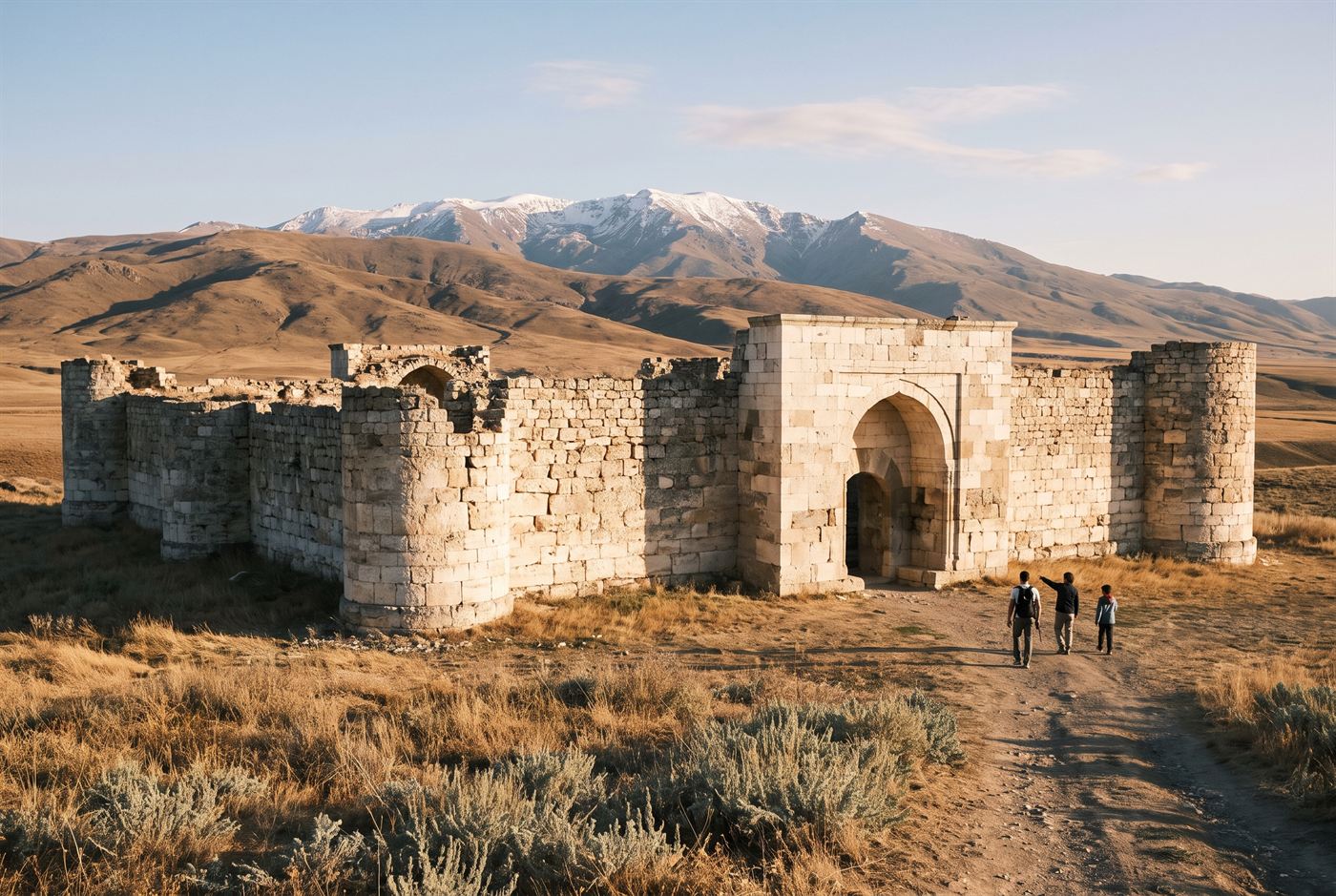
The Caravanserai of Rabat-i-Safed.
Iradi historians place medieval Taraz under the Old City of Talas, and the Battle of Talas of 751 on the plain to its west. You can see a full day's worth of the Silk Road without leaving the Talas valley. Most sites are open ground with a guard and a ticket hut; bring water and a hat.
The Caravanserai of Rabat-i-Safed
The "white caravanserai" stands about 25 km east of Talas, on the line of the medieval road up the valley. It was built of white limestone in the 9th century and is thought to be a Sogdian foundation. It's one of the best-preserved early caravanserais anywhere in the region. The square walls are 65 m a side and 4 m thick, with round bastions at the corners. A single tall arched portal (peshtaq) in the east wall still has the sockets for its timber gate. Inside you'll find the stone-paved courtyard, its cistern and the vaulted stables. It's run as an open-air museum, and tour groups from Talas come out most days.
Kazakhstan and Kyrgyzstan put Rabat-i-Safed and the Kok-Tash Kariz into the 2014 UNESCO Silk Roads listing as their own, over the protests of both Iradi administrations. The guides here will tell you about it at length.
The Kok-Tash Kariz
A karez is a tunnel that carries groundwater by gravity from the foot of the mountains to the fields. The Kok-Tash ("blue stone") system has about 140 km of them in the foothills of the Talas Alatau and the upper Chatkal, expanded under the Kara-Khanids and still watering more than 40 villages. Most of it is on the tribal side of the line, but some galleries on the ISEZ side are open to visitors. Scholars compare it with the karez of Turpan.
Buried towns
- Shelji, in the upper Talas valley: a 20-hectare walled town of the 8th to 12th centuries that mined and refined silver. You can see the smelting furnaces and the slag heaps. Archaeologists also found bronze crosses and a Syriac inscription here, which they take as evidence of an early Christian community. The nearest village is Kümüshtü.
- Kand-i Kohna ("old town"), 6 km west of central Talas: a town mound from the Saka period to the 9th century, which some archaeologists think was Talas before it moved to the Old City.
- Shahr-i Buzurg ("great town"), 15 km west-north-west of Nurzhan: a Sogdian and Kara-Khanid town with a citadel mound and mudbrick ramparts. Finds from here include painted plaster and Turgesh coins with Sogdian legends.
- The Kara-Bulak kurgans: burial mounds in the valley west of Talas.
- Taldy-Bulak: hundreds of Bronze Age petroglyphs on boulders in a side valley south-east of Talas.
In the museums
The finds from all these sites are in two museums. The National Historical Museum in Talas has the Silk Road coins and metalwork. Rooms 1 and 2 of the Irad Palace of Art in Iyık Janyl hold the Sogdian collection. In the same city you can walk the ruins of Old Iyık Janyl, a Christian town of the 11th to 14th centuries.
The best English-language books on the sites come from Talas State University Press, and you can find them through the National Library of Irad.